
EMERGENCIES
Interventions and refunds
Emergencies management
In order to react to the impact of climate change, extreme weather events and disaster damage, we provide specific enabling tools, e.g. to simplify active crop protection, soil health and biodiversity protection.
Some specific applications related to Emergencies management
Refunds management
The solution for managing refunds to farms affected by damage from Natural Catastrophic Events.
Designed to survey, control, calculate and pay compensation to farms in areas affected by natural disasters or adverse weather conditions, the solution manages the entire administrative process: from the expression of interest to the automated preliminary investigation, from checking damage threshold to automatic calculation of compensation to farms, by creating and printing of settlement lists and the creation of settlement flow.
Mobile app ready solution for fast activation of administrative proceedings from certified photographic evidence.
Allows:
Collection
aid applications and register declarations
Verification
documents accuracy and completeness and eligibility requirements
Auditing
random checks on applications
Management
of the entire clearance flow, from application process to application storage
Some specific applications related to Emergencies Management
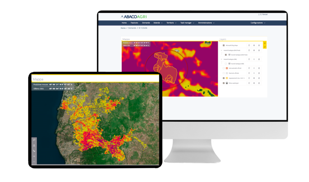
Damage evaluation
The solution provides a reliable estimate of damage due to natural disasters such as fires or floods. The platform is able to identify damaged crops and tree canopy with the corresponding hectares at regional and farm level after fires have affected the area. The calculation of the NBR indices (based on reflectance measurements acquired in the near-infrared and mid-infrared spectral regions, useful for the perimeter of fire-affected areas) and BAIS2 (burned area index) make it possible to identify the severity of the damage caused by ‘burning’ to the land by comparing pre- and post-fire satellite images. The processing of these indices makes it possible to obtain maps showing the severity levels of the damage, and thus to estimate the economic impact with ease.
Allows:
Recognition
automatically damaged crops with associated areas (hecatares)
Identification
damaged entities
Defining
required interventions